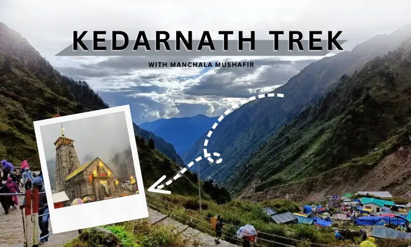
Introduction – Understanding the Journey Before You Start
The journey from Haridwar to Kedarnath Temple is one of the most spiritually significant and geographically diverse routes in India. This is not just a simple road trip—it is a gradual ascent from plains to high-altitude Himalayan terrain, combined with a challenging trek at the end.
When you begin from Haridwar, you are starting from one of the holiest cities in India, situated at a low altitude with relatively warm weather. As you move forward, each stage of the journey introduces:
- Increasing altitude
- Changing climate
- Narrower roads
- More rugged terrain
By the time you reach Kedarnath, you are in a completely different environment—cold, high-altitude, and surrounded by snow-covered peaks.
👉 This is why understanding every stage of the route in detail is extremely important. It helps you prepare physically, mentally, and logistically.
📍 Total Distance, Time & Route Overview (Detailed Explanation)
📊 Distance Breakdown
The journey consists of two major parts:
1. Road Journey:
- Approx distance: 240–260 km
- Travel time: 10–12 hours
- Nature: Mountain roads with curves and elevation gain
2. Trekking Route:
- Distance: 16–18 km
- Duration: 6–10 hours depending on pace
- Nature: Steep, uneven, high-altitude path
🧭 Why Travel Time Feels Longer
Even though the distance is not very high, the time required is longer because:
- Roads are not straight highways
- Continuous turns slow down vehicles
- Traffic increases during peak season
- Landslides or weather may delay travel
👉 So always plan buffer time instead of rushing.
🗺️ Complete Route Flow – Understanding the Travel Logic
Full Route:
Haridwar → Rishikesh → Devprayag → Srinagar → Rudraprayag → Guptkashi → Sonprayag → Gaurikund → Kedarnath
Why This Route is Followed
This route is not random—it follows:
- River valleys (Alaknanda & Mandakini)
- Gradual altitude increase
- Established road network
👉 This makes the journey safer and more manageable.
🟢 1. Haridwar → Rishikesh (Detailed Explanation)
Distance & Time:
- 25 km
- 45 minutes to 1 hour
What Happens in This Stretch
This is the transition zone between plains and hills.
- Roads are wide and smooth
- Traffic is moderate
- Weather is still warm
Why This Stretch is Important
Even though short, this part mentally prepares you for the journey ahead. Once you cross Rishikesh, the terrain changes completely.
👉 Rishikesh is also the last major town with full facilities like:
- ATMs
- Medical stores
- Good restaurants
🟢 2. Rishikesh → Devprayag (Detailed Explanation)
📸 Devprayag Confluence
Distance & Time:
Road & Terrain
- Narrow mountain roads begin
- Continuous turns and elevation gain
- Scenic river views throughout
Spiritual Importance
Devprayag is where:
👉 Bhagirathi + Alaknanda = Ganga River
This makes it one of the most sacred points in the journey.
Travel Insight
- Drive slowly
- Avoid motion sickness (common here)
- Take short breaks
🟢 3. Devprayag → Srinagar (Detailed Explanation)
Distance & Time:
Why Srinagar is Important
Srinagar is a major mid-point stop where you can:
- Refuel your vehicle
- Have proper meals
- Take rest
Road Condition
- Better than previous stretch
- Wider roads
👉 Ideal place to recharge before moving deeper into mountains.
🟢 4. Srinagar → Rudraprayag (Detailed Explanation)
Distance & Time:
What Makes This Stretch Special
You drive along rivers and mountains, with increasing altitude.
Religious Significance
Rudraprayag is the confluence of:
👉 Mandakini + Alaknanda rivers
Travel Note
- Roads start getting more narrow
- Drive carefully
🟢 5. Rudraprayag → Guptkashi (Detailed Explanation)
📸 Route Toward Guptkashi
Distance & Time:
Terrain & Experience
- Roads become steeper
- More sharp turns
- Scenic Mandakini river alongside
Why Guptkashi is Important
👉 This is the best base location before Kedarnath because:
- Good hotels available
- Medical facilities present
- Helicopter services operate
Travel Strategy
Most travelers stay overnight here to:
- Rest
- Acclimatize
- Prepare for trek
🟢 6. Guptkashi → Sonprayag (Detailed Explanation)
Distance & Time:
Key Role of Sonprayag
👉 This is the last point for private vehicles
You must:
- Park your vehicle
- Take local/shared transport
Why This Rule Exists
- Narrow roads ahead
- Heavy crowd during yatra
🟢 7. Sonprayag → Gaurikund (Detailed Explanation)
Distance:
Transport:
Importance of Gaurikund
👉 This is the starting point of the Kedarnath trek
Facilities available:
- Basic hotels
- Food stalls
- Trek registration
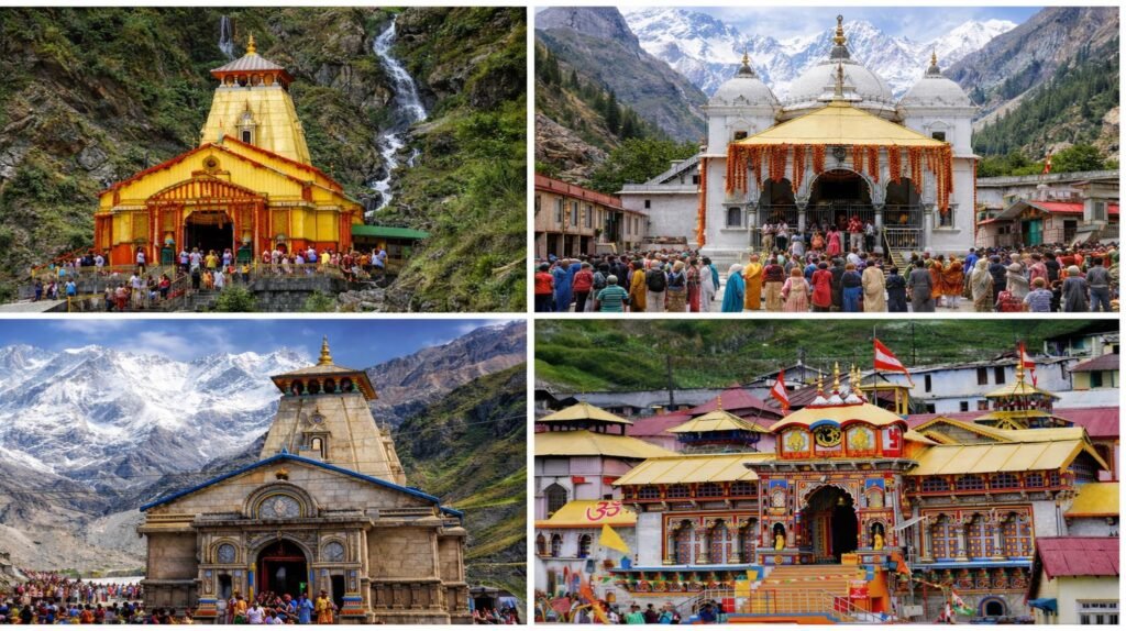
🥾 Kedarnath Trek Route – Complete Detailed Explanation
📸 Trek Experience
Distance & Duration
Trek Nature
- Continuous uphill
- Rocky and uneven path
- High altitude
Key Stops Explained
1. Jungle Chatti
- First rest point
- Food & water available
2. Bheembali
- Mid-point
- Medical help available
3. Linchauli
- Near destination
- Oxygen levels lower
4. Kedarnath Base
- Final stretch
- Cold weather
Trek Options Explained
- Walking → best for fit travelers
- Pony → moderate comfort
- Palki → best for elderly
- Helicopter → fastest
🗓️ Ideal Travel Itinerary (Detailed Explanation)
Day 1:
Haridwar → Guptkashi
👉 Long drive but necessary to reduce next day pressure
Day 2:
Trek to Kedarnath
👉 Start early to avoid fatigue
Day 3:
Return trek
👉 Take rest and descend slowly
Day 4:
Return to Haridwar
👉 Relaxed journey back
🌤️ Best Time – Detailed Understanding
May–June:
- Comfortable weather
- High crowd
September–October:
Avoid Monsoon:
⚠️ Safety Tips – Detailed Insight
Road Safety
- Avoid night driving
- Be careful on turns
Trek Safety
- Walk slowly
- Stay hydrated
- Take breaks
Weather Safety
- Carry rain gear
- Check forecast
🧠 Practical Ground Reality (Very Important)
- Network is weak
- Roads are narrow
- Facilities basic near temple
- Weather unpredictable
👉 Mental preparation is crucial.
❓ Frequently Asked Questions
How far is Kedarnath from Haridwar?
Around 250 km by road plus 16–18 km trek.
Is trekking compulsory?
Yes, unless you take helicopter.
How many days are ideal?
4–5 days.
Is route safe for families?
Yes, with proper planning.
Can beginners do this trip?
Yes, but preparation is needed.
🏁 Conclusion – More Than a Route, It’s a Transformation
The route from Haridwar to Kedarnath is not just a path on a map—it is a journey through changing landscapes, increasing challenges, and deepening spirituality.
Every segment of the route prepares you for the next:
- The plains teach patience
- The mountains build strength
- The trek tests your determination
And when you finally reach Kedarnath, you realize that the journey itself has transformed you.
👉 Kedarnath is not just a destination—it is an experience shaped by every kilometer you travel.
With proper planning, awareness, and respect for the mountains, this journey becomes safe, smooth, and truly unforgettable.